Holy Island - Lindisfarne
Holy Island, or Lindisfarne, lies about ten miles south of Berwick. The island is linked by a road, or causeway, that floods twice a day. When the causeway is flooded there is no access to or from the island either by road or by foot. It is very important to observe the safe crossing times, which change daily. Each year several motorists attempt to beat the tides and end up getting stranded. Their fate is to then be rescued by helicopter with accompanying photographs in the Berwick Advertiser. Most car insurance does not cover the subsequent sea water damage. Having said all that, a visit to the island is well worth while.
Holy Island Safe Crossing Times
The following crossing times are provided by Northumberland County Council. Ness Street is not in a position to check their accuracy and you rely on them at your own risk. If the road looks flooded stop!
2025
Jan Feb March April May June July Aug Sept Oct Nov Dec
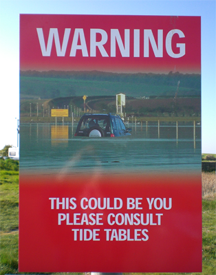
Sign at the start of the causeway
Getting to Holy Island
By Car: Drive south from Berwick on the A1 for about 7 miles. Turn left at the sign for Holy Island. (There is the Lindisfane Inn hotel and a petrol station just beyond this turning on the A1). Then follow the road, which will take you over a railway level crossing, past the Barn at Beal on your left and then continue to the causeway start.
By Bus: The 477 runs from Berwick to Holy Island. It does not run every day and its departure times vary because of the tides. It is best to call in at the Berwick tourist information centre for the times for the week that you are staying.
By Cycle: There is a Nation Cycle Network route from Berwick to Holy Island, a large portion being traffic free. See this Sustrans interactive map for more details. (This site can be a little slow in responding - be patient)
The Barn at Beal
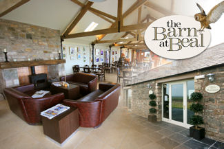
The Barn at Beal is well worth including in any visit to Holy Island. The cafe offers a range of food, from tea and coffee right through to full meals. It is located on the road from the main A1 to Holy Island, just before the start of the causeway. It is well signposted and you can't really miss it.
In addition to the cafe, the complex houses a Birds of Prey centre. Flying displays are given at 2pm in suitable weather. Again, highly recommended.
On the island itself you might wish to try Pilgrims Coffee House
Also see this map for other cafes and pubs.
At High Tide
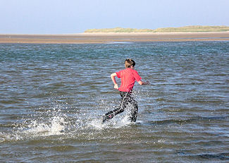
The causeway at high tide is often neglected by the casual visitor. It is well worth parking at the mainland end of the causeway, where there is a free car park, at around the time marked as the end of safe crossing. The incoming tide covers the road in about half an hour. Children enjoy splashing about in the shallow waters - wellington boots are recommended, as are a change of clothes and a towel!
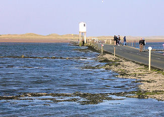
Causeway just before high tide
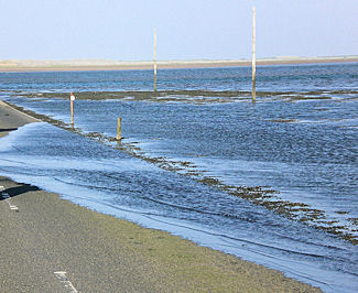
The road starting to flood
On the Island
Once you cross the causeway there is a drive of a mile or so before arrving at Holy Island village. There is a well signposted visitor's car park just before the start of the village proper. Traffic is forbidden from entering the village, except for access to properties.
Try this map of cafes, pubs, shops and other attractions on the island .
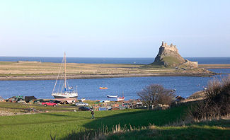
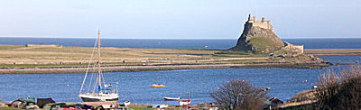
Lindisfarne Castle
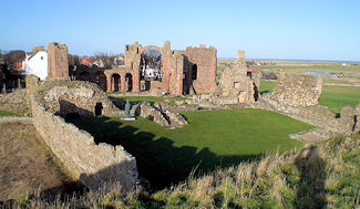
The ruined Abbey
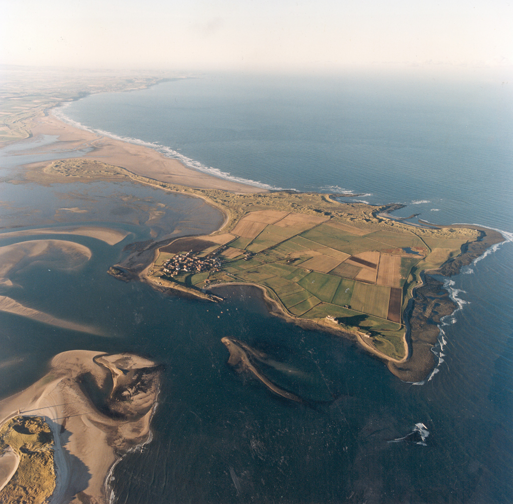
Aerial View of Holy Island (click image for larger picture)
Picture by permission of Northumberland Coast AONB